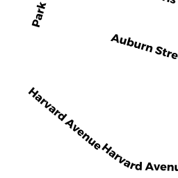
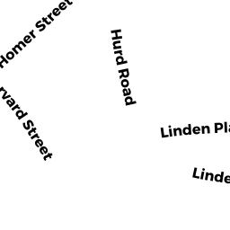
63 HARVARD AVE 63-3&G4P4
Owner Information
XUE-JUN YUAN
63 HARVARD AVE #63-3
BROOKLINE, MA 02446


Property Details
63 HARVARD AVE 63-3&G4P4 is classified as a Residential Condominium (Duplex).
The primary structure on this property was built in 1863. There is 2,603ft2 of residential/living space within this property. This property is listed as having 7 rooms.
63 HARVARD AVE 63-3&G4P4 is valued at $2,129,100. The land is valued at $0 and the structures are valued at $2,129,100.
This property is in Zone M10. Confirm with local Zoning Board authorities to ensure there are no overlays or other easements on this property.
The most recent deed for 63 HARVARD AVE 63-3&G4P4 is recorded at the local registrar in Book 28403, Page 18. 63 HARVARD AVE 63-3&G4P4 was last sold on Thursday, December 16, 2010 for $1,230,000.
Assessment data from fiscal year 2021.
Flood Data
According to the FEMA National Flood Hazard Layer, this property does not appear to be in a flood zone. It may also be in an area not yet reviewed. Nonetheless, confirm this information prior to taking any action.
To view the flood hazards around this property, create a FEMA "Firmette" Map of the area around 63 HARVARD AVE 63-3&G4P4.
Broadband Internet Providers
| Provider | Type | Bandwidth (mbps) | |
|---|---|---|---|
| Starry, Inc. | Fixed Wireless | 200 | 200 |
| VSAT Systems, LLC. | Satellite | 2 | 1 |
| HughesNet | Satellite | 25 | 3 |
| GCI Communication Corp. | Satellite | 0 | 0 |
| netBlazr Inc | Fixed Wireless | 50 | 50 |
| RCN | Cable | 1000 | 20 |
| RCN | Cable | 500 | 20 |
| Comcast | Cable | 1000 | 35 |
| Verizon New England Inc. | DSL | 15 | 1 |
| Viasat Inc | Satellite | 100 | 3 |
| Crown Castle Fiber | Fiber | 0 | 0 |
Broadband service provider data from December 2020.
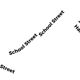
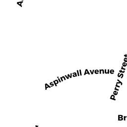
Adjacent Properties
- 71 HARVARD AVE
Two-Family Residential owned by KURTZMAN JONATHAN & DEBRA A - 14 AUBURN PL
Single Family Residential owned by MILSTEIN ROBERT LEE - 4 WASHBURN PL
Two-Family Residential owned by POSELL ANNETT L - 45 HARVARD AVE 45-2 & G31
Residential Condominium owned by HART DENNIS C - 51 HARVARD AVE 51-1 & 0-3
Residential Condominium owned by CATALTEPE OGUZ & SULE - 55 HARVARD AVE 55-4 & G8
Residential Condominium owned by ROSSIN DAVID E - 55 HARVARD AVE 55-5 & G24
Residential Condominium owned by GREENE JOSHUA E - 45 HARVARD AVE 45-1
Residential Condominium owned by HANNAGAN KERI M - 45 HARVARD AVE 45-3 & G26
Residential Condominium owned by BLOOM MICHELLE PARSONS - 45 HARVARD AVE 45-4 & G3
Residential Condominium owned by KARNIK AMOL M - 47 HARVARD AVE 47-1 & G17
Residential Condominium owned by KLEIN LINDA D - 47 HARVARD AVE 47-2 & G6
Residential Condominium owned by GRANIK ALEXANDER - 47 HARVARD AVE 47-3 & G2
Residential Condominium owned by GONZALEZ TRS MARILYN & MAXIMILLIAN E - 47 HARVARD AVE 47-4 & P13
Residential Condominium owned by WONG PAK SHAN SIMON - 47 HARVARD AVE 47-5 & P2
Residential Condominium owned by LIAO SHU YI - 47 HARVARD AVE 47-6 & G7
Residential Condominium owned by WU CHIA -LING - 49 HARVARD AVE 49-1 & G32
Residential Condominium owned by KIRKHAM JOHN C - 49 HARVARD AVE 49-2 & G15
Residential Condominium owned by ALONSO MARIA ISABEL - 49 HARVARD AVE 49-3 & G9
Residential Condominium owned by SHEKHEL HARRY & ELENA - 49 HARVARD AVE 49-4 & G5
Residential Condominium owned by MARGOLIS JONATHAN - 49 HARVARD AVE 49-5 & G27
Residential Condominium owned by NOSATOV OLGA & VLADIMIR - 49 HARVARD AVE 49-6 & G14
Residential Condominium owned by PIRYATINSKY MAXIM & IRENE - 51 HARVARD AVE 51-2 & P21
Residential Condominium owned by BOGDANOVIC DEAN & BLANKA - 51 HARVARD AVE 51-3 & G4
Residential Condominium owned by XU MIN - 51 HARVARD AVE 51-4 & G22
Residential Condominium owned by LI JICHAO - 51 HARVARD AVE 51-5 & P6
Residential Condominium owned by LENBURG MARC E - 51 HARVARD AVE 51-6 & G25
Residential Condominium owned by DAI JING - 53 HARVARD AVE 53-1 & O-1
Residential Condominium owned by ZHENG ZHIXIAN - 53 HARVARD AVE 53-2 & G20
Residential Condominium owned by PERISKIC SASA - 53 HARVARD AVE 53-3 & G29
Residential Condominium owned by CHEN DOROTHY Y - 53 HARVARD AVE 53-4 & G30
Residential Condominium owned by SHU ET AL YONG - 53 HARVARD AVE 53-5 & P11
Residential Condominium owned by DARVISH SHAHAN M & BIJAN - 53 HARVARD AVE 53-6 & G12
Residential Condominium owned by WALSH BRIAN - 55 HARVARD AVE 55-1 & P4
Residential Condominium owned by SANSOM RYAN S - 55 HARVARD AVE 55-2
Residential Condominium owned by WEI WENYI - 55 HARVARD AVE 55-3 & G16
Residential Condominium owned by BASSOV IVAN & TATYANA - 55 HARVARD AVE 55-6 & G1
Residential Condominium owned by LEE SABRINA - 57 HARVARD AVE 57-1 & G10
Residential Condominium owned by YANG XIAOHUI - 57 HARVARD AVE 57-2 & G23
Residential Condominium owned by LU XIAOLAN - 57 HARVARD AVE 57-3 & P5
Residential Condominium owned by REYNOLDS DOUGLAS & KIMBERLY - 57 HARVARD AVE 57-4 & G18
Residential Condominium owned by SHULKIN MIKHAIL - 57 HARVARD AVE 57-5 & P19
Residential Condominium owned by YANG ZHIYONG - 57 HARVARD AVE 57-6 & G28
Residential Condominium owned by SHAFIR FRANCES J - 59 HARVARD AVE 59-1 & P7
Residential Condominium owned by TAYLOR TRS MARK F & CAROL W - 59 HARVARD AVE 59-2
Residential Condominium owned by AIUDI CHRISTOPHER